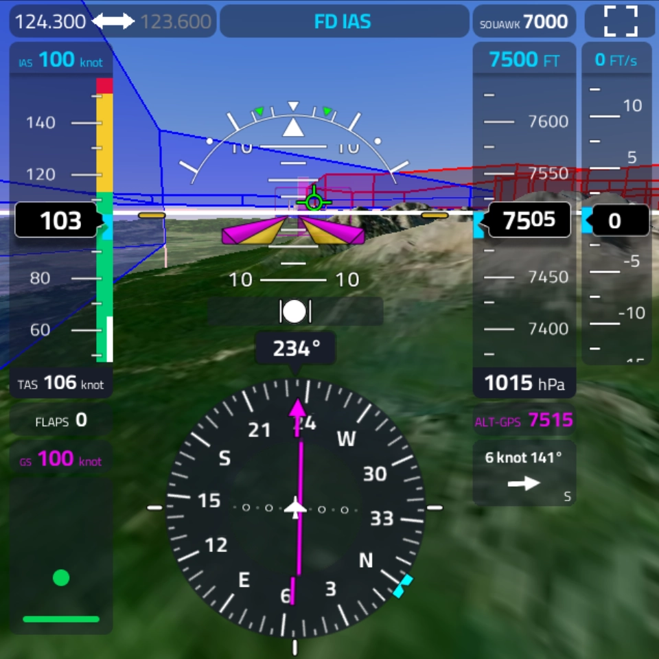
On a typical manned ISR mission, everything falls on the crew on board: fly the aircraft, manage sensors, coordinate with command, and make real-time decisions simultaneously, sometimes in harsh conditions.
Schochman’s system enables a model where:
The architecture for the transition from a manned to optionally manned aircraft that stays regulation-compliant today, while giving your ground team live mission control and assistance from the ground station.
In development for a 600kg MTOW fixed-wing aircraft.
A pilot on board means your existing manned aircraft approvals continue to apply. No new RPAS exemptions, no special authorisations. You gain ground-side mission control without navigating a separate regulatory path.
A SAR coordinator, incident commander, or operations officer sees 1:1 what the pilot and aircraft see (views from cameras, flight & engine parameters, nav data, etc.)
and assigns tasks in real time, without being airborne.
The platform is architected for optional unmanned operation. As regulations evolve, transitioning to reduced crew or remote operation is a configuration change and not a fleet replacement.
"Operators work across fragmented tools rather than a single mission picture, increasing workload."
ISR Mission Commander
"In a moving vehicle with three assets airborne, every missed keystroke is a distraction I can't afford."
UAS Field Operator, Border Ops
"A weather alert, a sensor warning, comms: all at once and each needs decoding. Ideal setup for mistakes."
GCS Operations Specialist
The sensor payload is specified for your operational requirement: thermal, EO/IR, high-resolution optical, or multispectral.
The command and control of your fleet deploys as a portable suitcase or hand-held unit; 500+ TOPS of AI processing power, safe in the groud station, instantly available to every connected vehicle.
Backpack-deployable, from 2 kg. Rapid deployment for first-on-scene ISR, aerial search grids, and forward reconnaissance. Payload-configurable: EO/IR, thermal, optical.
Up to 30 kg payload capability for heavy sensors: high-resolution optical, multispectral, SAR. Built for extended missions where sensor performance outweighs portability.
Compact ground vehicle for confined spaces, urban corridors, and indoor reconnaissance. Operates in environments where UAVs cannot safely loiter.
All-terrain ground vehicle for rough terrain, forest approaches, and perimeter surveillance. Carries heavier sensor payloads than the 2WD variant with full ground mobility.
Vehicles (designed and built in-house) connect to the same ground station. One vendor. One support contract. No integration surprises.
If a vehicle is lost, damaged, or under maintenance, the intelligence layer is unaffected. Any replacement vehicle is operationally ready the moment it connects.
Sensor feeds, nav data, telemetry from every connected vehicle converge into a single fused operational display, allowing you to task vehicles one by one or as a group.
Coordinate UAVs, and ground vehicles across a search grid from a single incident command post. GNSS-denied navigation keeps operations running in mountain gorges, dense forest, structurally compromised buildings. AI object detection flags heat signatures, movement without requiring a dedicated sensor operator for each asset.
Persistent aerial and ground surveillance of energy infrastructure, water systems, and transport networks with AI-assisted anomaly detection. Mission logs, sensor feeds, and AI outputs stay within your infrastructure — on EU-hosted cloud or fully on-premise. No data leaves without your authorisation.
AI-decoded alerts, voice-commanded multi-vehicle control, and a single operational picture reduce operator workload during large-scale incidents. One commander. One display. Multiple assets in the air and on the ground, without a dedicated pilot for each.
Quadcopter
Backpack-deployable, from 2 kg. Rapid deployment for first-on-scene ISR, aerial search grids, and forward reconnaissance. Payload-configurable: EO/IR, thermal, optical.
Octocopter
Up to 30 kg payload capability for heavy sensors: high-resolution optical, multispectral, SAR. Built for extended missions where sensor performance outweighs portability.
2WD
Compact ground vehicle for confined spaces, urban corridors, and indoor reconnaissance. Operates in environments where UAVs cannot safely loiter.
4WD
All-terrain ground vehicle for rough terrain, forest approaches, and perimeter surveillance. Carries heavier sensor payloads than the 2WD variant with full ground mobility.
in development
Hosted on a protected cloud where you need or fully on-premise. No vendor lock-in.
Flight data, sensor feeds, and mission records remain on-premise or within EU-controlled infrastructure.
You retain full operational control regardless of connectivity status. No remote kill switch. No geofencing from outside your organisation. The system operates exactly as configured, in denied or degraded environments.
We’ll specify the system around it,
as every deployment is specified for the mission: vehicle mix, sensor payload, comms architecture, data storage.